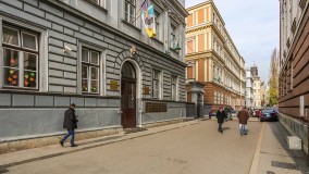
Vijećnica Museum
Obala Kulina bana 1
Sarajevo is a city that has had a turbulent past and in a little more than a century it was part of eight different states: the Ottoman Empire, the Austro-Hungarian Empire; the State of Slovenes, Croats and Serbs; the Kingdom of Slovenes, Croats and Serbs; the Independent State of Croatia, the Socialist Federal Republic of Yugoslavia and an independent Bosnia and Herzegovina. More
Street
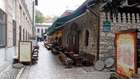
Sarači, Sarajevo | Map
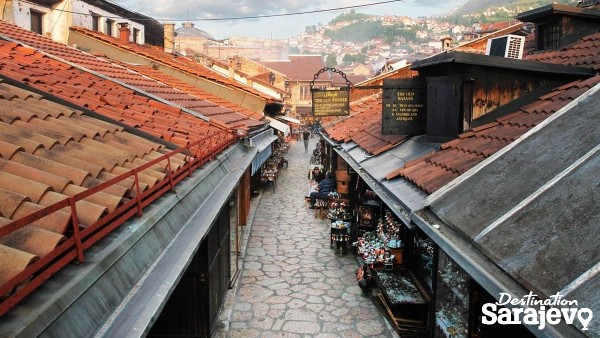
Street Sarači is the longest street in Baščaršija. Running west to east, it goes from Gazi Husrev-Begova St. and the popular SlatkoĆoše (Sweet Corner) to Baščaršija St. (Baščaršija Square)... More
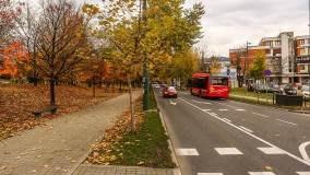
Street
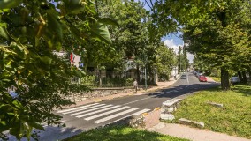
Zelenih beretki, Sarajevo | Map
Street Zelenih Beretki St. runs west to east, from Trg Oslobođenja- Alija Izetbegović to Kundurdžiluk St. More
Street
Abadžiluk, Sarajevo | Map
Street If you head south from Baščaršija Square, you’ll run into Abadžiluk Street, which leads to Obala Kulina Bana St. and the Miljacka River. More
Street
Alipašina, Sarajevo | Map
Street The greater extent of Alipašina runs south to north, from Maršala Tita to Koševo Stadium, where it veers west toward Kobilja Glava. More
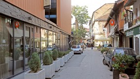
Street
Aščiluk, Sarajevo | Map
Street Aščiluk Street runs parallel to Kundurdžiluk St. and is connected to it by two smaller streets. Bazardžani St. joins Aščiluk St. from the east and, if you head west on this street, you will come to Zelenih Beretki St... More
Street, Square
Austrijski trg, Sarajevo | Map
Street, Square Austrijski Trg (Square) is located on the left bank of the Miljacka, below the neighborhood of Bistrik. More
Square
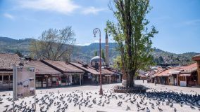
Baščaršija, Sarajevo | Map
Square Baščaršija is a wide street, actually a square, that begins at the spot where Telali, Safvet-Beg Bašagića, Sagrdžije and Mula Mustafe Bašeskije all meet in the north and it runs toward Abadžiluk and Hal... More
Street
Bistrik, Sarajevo | Map
Street Bistrik, one of Sarajevo’s oldest streets, is a major road that runs through the neighborhood of the same name. More
Street
Brodac, Sarajevo | Map
Street Brodac Street runs along the western side of Vijećnica and joins the streets, Telali and Obala Kulina Bana. More
Street
Ćulhan, Sarajevo | Map
Street Ćulhan is a short and narrow street that lies parallel to the much wider and longer Sarači, and runs west-east, from Prote Bakovića St. to Baščaršija St. (Baščaršija Square). More
Street
Dalmatinska, Sarajevo | Map
Street The main part of Dalmatinska runs from south to north, stretching uphill from Maršala Tita to Mejtaš. At Buka St. one small part breaks off to form a cul-de-sac that runs east to west. More

Street
Džemala Bijedića, Sarajevo | Map
Street This street runs from Čengić Vila in Novo Sarajevo to Stup in Ilidža Municipality, and includes a few smaller streets, which connect to one another. More
Street
Džidžikovac, Sarajevo | Map
Street Džidžikovac runs from Koševo (SW) to Čekaluša (NE). More
Street
Sarajevo | Map
Street Đulagina Street connects Mula Mustafe Bašeskije St. and Sarači St. More
Street
Gimnazijska, Sarajevo | Map
Street Gimnazijska connects Obala Kulina Bana (south) with the Zelenih Beretki, Branilaca Sarajeva and Muhameda Kantardžića junction (north), and is on the border between Stari Grad and Centar Municipalities. More