Ćurčiluk
Ulica Ćurčiluk
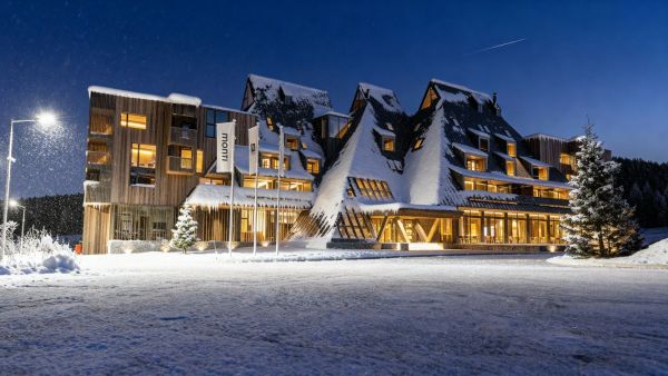
Olympic Oasis is an exclusive mountain resort located in the peaceful, untouched area of Dvorišta, just 45 minutes from Sarajevo Airport. More
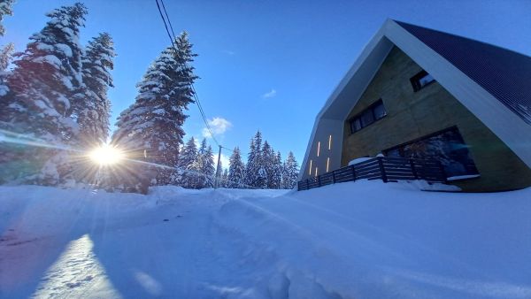
On the Olympic mountain Igman, about half an hour from Sarajevo’s city center, you'll find a unique winter getaway. More
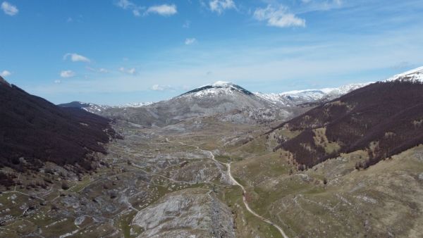
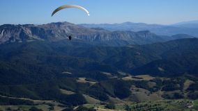
Although best known as a winter ski resort, Bjelašnica Mountain is a great summer escape from Sarajevo’s heat. Located just 35 km from the city, it’s about a 40-minute drive away. More
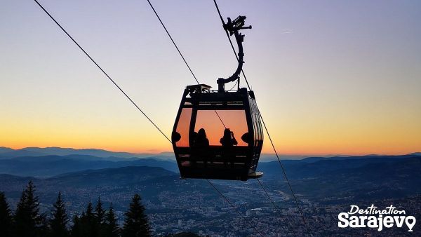
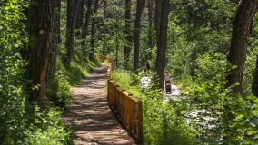
If you'd like to escape the urban milieu and relax in lovely and virtually untouched nature, we recommend that you pay a visit to some of the better-known excursion sites around Sarajevo. The hills around the city have turned green, so don't forget to bring your cell phone or camera to capture the beautiful scenes of nature. More
In the collective memory of the people living in the area of the former Bosnian kingdom, many historical stories have remained in lasting memory. And yet only a small group of people can tell you the story of Dorothea of Bulgaria. When asked who the last Bosnian queen was, every Bosnian will surely respond without thinking - Katarina Kosača. However, once asked about the first Bosnian queen, most remain silent. More
Around Sarajevo
Bjelašnica, Sarajevo | Map
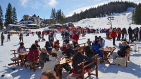
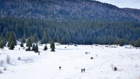
Around Sarajevo Babin Do is the largest ski area around Sarajevo and is located on the Olympic Mountain, Bjelašnica, about 30 kilometers from the center of town. This popular ski center is a favorite spot for both professional skiers and a... More
Around Sarajevo
Sarajevo | Map
Around Sarajevo The recreation area, Barice, is seven kilometers from the center of Sarajevo. More
Around Sarajevo
Ilijaš | Map
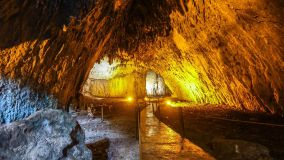
Around Sarajevo The Bijambare protected area covers 497 hectares within the Sarajevo municipality of Ilijaš (about a 40-minute drive from the center of Sarajevo) and is not far from the Sarajevo-Tuzla Highway. More
Around Sarajevo
Bjelašnica | Map
Around Sarajevo The beauty of Mt. Bjelašnica, which is only 35 km from the center of Sarajevo, can be enjoyed throughout the year. More
Around Sarajevo
Sarajevski Ozren | Map
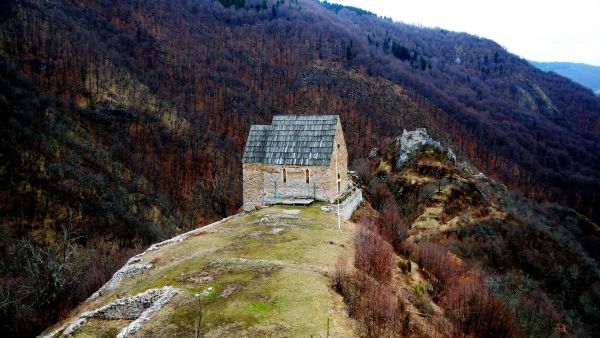
Around Sarajevo At 1,532 meters above sea level, Bukovik is the highest peak of the mountain, Sarajevo's Ozren, which lies northeast of Sarajevo. More
Around Sarajevo
Sarajevo | Map
Around Sarajevo Čavljak is considered a very popular outing destination among Sarajevans. It is only ten kilometers from the center of Sarajevo and four kilometers from the picnic grounds of Barice, which can be reached by taking the asphalt road... More
Around Sarajevo
Crepoljsko bb, Istočno Sarajevo | Map
Around Sarajevo About 18 kilometers north of Sarajevo lie the gentle slopes of Sarajevo Ozren, which wrap around Crepoljsko Peak (1,524 m). More
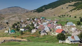
Around Sarajevo
Bjelašnica | Map
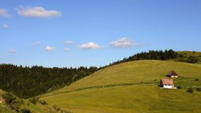
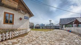
Around Sarajevo Lukomir – the last true Bosnian village – is about 50 kilometers from Sarajevo. The village is situated in an area of Bjelašnica Mountain, which forms one of the ridges of the fascinating Rakitnica River Canyon. More
Around Sarajevo
Poljice, Istočno Sarajevo | Map
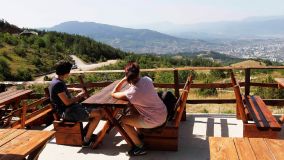
Around Sarajevo Poljice Plateau is the first place visitors encounter when they come to Jahorina Olympic Center. Poljice is home to several excellent hotels, many eateries and cafes and the weekend settlement, Šator. More
Around Sarajevo
Sarajevo | Map
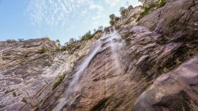
Around Sarajevo The natural monument Skakavac takes in the area around Skakavac Waterfall, which is approximately 13 kilometers north of the center of Sarajevo. More
Around Sarajevo
Bjelašnica | Map
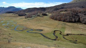
Around Sarajevo The valley of Studeni Potok (stream), is located near the village of Umoljani, on the southern side of Bjelašnica, about 50 kilometers from the center of Sarajevo. More
Around Sarajevo
Trebević | Map
Around Sarajevo It’s hard not to notice Trebević, with its distinctive peak towering over the south side of Sarajevo. More
Around Sarajevo
Bjelašnica | Map
Around Sarajevo The village of Umoljani, on Mount Bjelašnica, is about an hour’s drive from Sarajevo. More
Around Sarajevo
Igman, Sarajevo | Map
Around Sarajevo Veliko Polje on Mt. Igman is a favorite picnic spot for Sarajevans, in winter and throughout the rest of the year. Nestled in the middle of a deep pine forest, Veliko Polje is classed among some of the best locations in... More
Around Sarajevo
Nišićka visoravan | Map
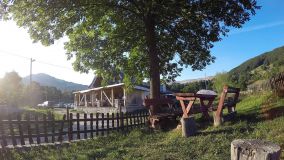
Around Sarajevo Bey’s Ethno Village is nestled in the thick forests of Nišićka Plateau (1,400 m) and this complex is an authentic replica of a Bosnian mountain village. More